3 weeks Ago By Adam Del Rosso
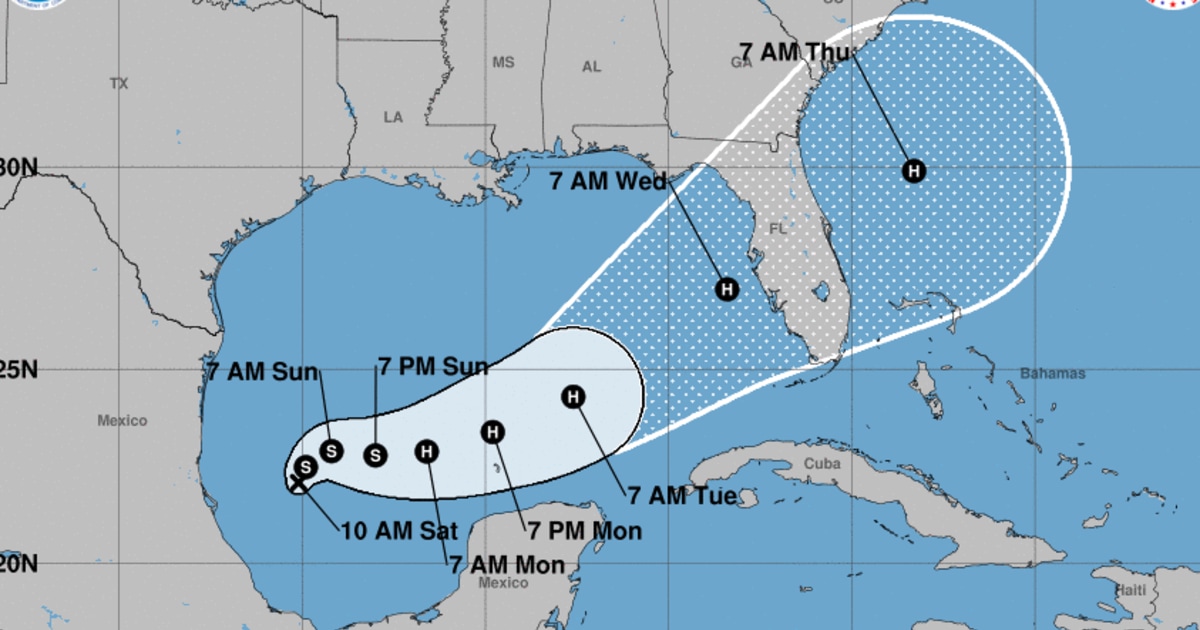
MINNEAPOLIS — Clouds and spotty showers will make for a slightly cooler start to the weekend. The forecast this weekend is driven by two factors: a cold front from the Dakotas and leftovers from Hurricane Francine. Both will throw some extra clouds our way keeping highs this afternoon closer to 80°.
Some rumbles of thunder and showers are possible today, but they won't be terribly impactful — likely less than .10" of rainfall. Most of that moisture looks to shift east by tomorrow, replaced by sunshine.

Highs will return to the mid 80s for the Vikings home opener. Some models hint at a stray shower lingering into early Sunday morning and then again on Monday morning. We stay in the 80s with a mix of sun and clouds into next week with better rain chances toward the end of the week.
By next weekend, it looks like the pattern turns cooler and more unsettled. Born and raised in Pittsburgh, Pennsylvania, weather has been a passion for Adam for as long as he can remember! Whether it was thunderstorms or winter storms, Adam has always been geeking out. After earning his meteorology degree from Penn State, he made his way to the Ohio Valley to forecast for WTOV.
.