 16 hours Ago By The Weather Network
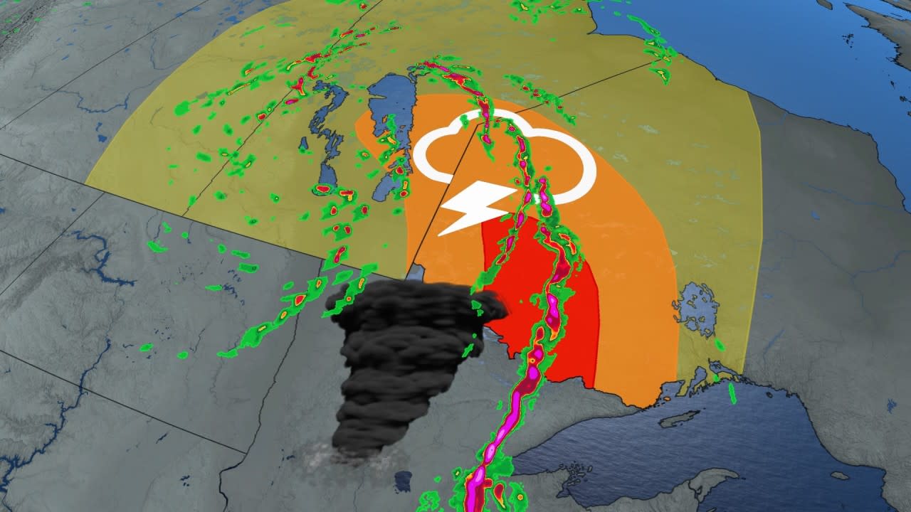
A that has spent two days maturing this week will provide its most impressive round of severe weather on Thursday. Although the low will still be situated over the middle of the Prairies, the action will be in northwestern Ontario. The cold front will feed on pockets of impressive energy east of Lake of the Woods and west of Thunder Bay on Thursday, helping to create a conducive environment for severe thunderstorms, and even one or two tornadoes, too.
It will be important to pay close attention to the in case severe weather occurs. Have a plan in place to seek safe shelter in case severe weather , your office, or . The most impressive dynamics for tornado potential will remain in Minnesota for the day, but the risk will extend as far north as Red Lake.

While the tornado risk will be in place, large hail and damaging wind gusts exceeding 100 km/h will be the main hazards. Thunder Bay will miss the strongest time frame of the storms but post-sunset storms will reach Lake Superior. Beyond Thursday, showers and thunderstorms will continue to track east across the region this weekend ahead of a cold front.
Temperatures will trend somewhat cooler behind the front, but still on the warm side of seasonal. Widespread rain is possible for areas east of Lake Superior in early or the middle of next week. While next week will be noticeably cooler than this week, temperatures will continue to be warmer than normal and will trend well above normal for the final days of September, and possibly into the beginning of October.
.


-and-Aiden-Upward-produced-a-65-run-partnership.jpeg?auto=webp&width=1200)