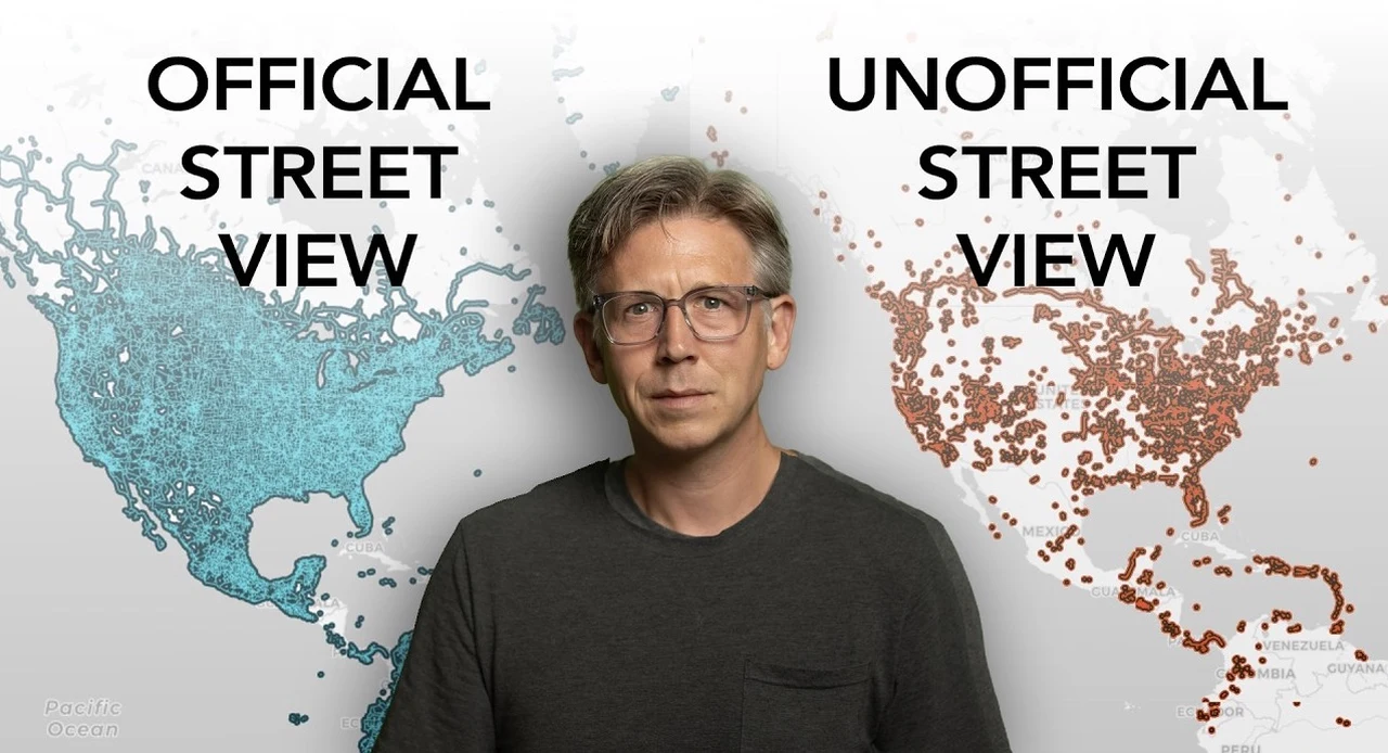
Google Street View has evolved far beyond its initial conception as a virtual navigation tool. Today, it stands as a complex, dynamic ecosystem enriched by unofficial contributions from a diverse array of sources. From individual enthusiasts to government bodies, these contributors play a crucial role in enhancing the platform’s depth, utility, and global reach by uploading imagery such as photospheres and street-level images.
Phil Edwards reveals more insights into the intricate web of motivations behind these contributions and explores their broader economic and social implications. Whether it’s a local tourism board aiming to boost its region’s visibility or a business owner creating a virtual tour to attract customers, these contributions have far-reaching economic and social implications. As we provide more insight into this collaborative digital mapping revolution, you’ll discover how these efforts not only enhance our virtual explorations but also play a crucial role in supporting industries, aiding emergency responders, and even influencing urban planning.
Google Street View is enriched by unofficial contributions from individuals and organizations, providing imagery like photospheres and street-level images to enhance its depth and utility. Contributors aim to fill gaps in Google’s coverage, offering perspectives from remote or underrepresented areas that Google’s mapping vehicles might miss. Motivations for contributing include enhancing local visibility, promoting tourism, boosting business presence, and supporting emergency services with accurate mapping.
Contributions have significant economic impacts, improving SEO for businesses, aiding in property assessment, and supporting urban planning and development. Technological advancements and community collaboration are crucial for capturing high-quality imagery, with ongoing efforts to map less-covered regions despite challenges in funding and organization. Around the globe, individuals and organizations are actively contributing to Google Street View, providing imagery that Google’s own resources might not capture.
These contributions include: 360-degree photospheres offering immersive views Detailed street-level images enhancing local representation User-generated content filling gaps in remote or underrepresented areas Specialized imagery showcasing unique locations or events This collaborative approach significantly enriches the platform by offering more comprehensive and localized views. It effectively transforms Street View from a corporate-driven project into a , where each contribution adds a unique piece to the world’s digital map. The reasons for contributing to Google Street View are as diverse as the contributors themselves.
Understanding these motivations provides insight into the platform’s value across different sectors: Communities and tourism boards contribute imagery to promote their regions, attracting visitors and boosting local economies. This digital presence can be particularly impactful for lesser-known destinations seeking to increase their profile on the global stage. Companies create virtual tours to showcase their offerings, effectively extending their storefronts into the digital realm.
This enhanced online presence can significantly boost search engine visibility and attract potential customers. Accurate and up-to-date mapping provides crucial information for first responders during emergencies. Detailed street-level imagery can help plan routes and identify potential hazards before arriving on scene.
Academic institutions and researchers use Street View data for various studies, from urban development to environmental monitoring. Unlock more potential in imagery uploading by reading previous articles we have written. The economic implications of contributions to Google Street View extend far beyond simple navigation.
This digital mapping ecosystem has become a powerful economic driver: For businesses, appearing on Street View can significantly improve search engine optimization (SEO), potentially leading to increased foot traffic and online engagement. Governments and companies often collaborate to map regions, using Street View data for property assessment, urban planning, and economic analysis. This data becomes an invaluable tool for making informed decisions about infrastructure development and resource allocation.
Detailed street-level imagery can entice potential visitors by providing a virtual preview of destinations, potentially increasing tourism revenue for featured locations. The ability to virtually explore neighborhoods and properties through Street View has transformed the real estate industry, allowing potential buyers to conduct preliminary research remotely. The success of Google Street View relies on a symbiotic relationship between advanced technology and community engagement: Advanced cameras and specialized mapping vehicles are essential for capturing high-quality, immersive imagery.
These technologies enable the detailed documentation of areas, contributing to comprehensive mapping projects. Local groups often take the lead in documenting remote or underrepresented regions. These grassroots efforts not only fill gaps in coverage but also ensure that local knowledge and perspectives are accurately represented.
Google’s sophisticated algorithms process and integrate the vast amounts of contributed imagery, making sure seamless integration with existing map data. While Google Street View’s global impact is significant, with ongoing efforts to map regions in Africa and other less-covered areas, challenges remain: Funding large-scale mapping projects in developing regions Navigating privacy concerns and legal restrictions in different countries Making sure equitable representation across diverse communities Maintaining up-to-date imagery in rapidly changing urban environments Despite these obstacles, the collective drive to document and represent diverse regions continues, reflecting a shared interest in global visibility and digital representation. As technology advances and community engagement grows, the potential for expanded coverage and new applications of Google Street View is immense.
Future developments may include: Enhancing real-world navigation with overlaid digital information. Creating a visual timeline of locations, allowing users to “travel back in time” and observe changes over years. Using Street View data to track changes in vegetation, urbanization, and climate impact over time.
Documenting and preserving cultural heritage sites in detailed 3D models. The ongoing contributions from individuals and organizations to Google Street View reflect a shared pride in local representation and a commitment to enhancing global connectivity. As the platform continues to evolve, it stands as a testament to the power of collaborative digital mapping, offering new opportunities for exploration, understanding, and global connection.
Media Credit:.


