Spring is nearly here, with the vernal equinox this Thursday at 5:01 a.m., when the direct rays of the sun are above the equator, heading north, as day and night are about equal.
Unlike a typical March in the Berkshires, with wintry weather hanging tough, this weekend and next week will seem more like April. Temperatures will be far above average, especially during daytime. But moderate to heavy showers are expected to dampen the final hours of this weekend, beginning Sunday evening and continuing into Monday morning.

The National Weather Service in Albany, N.Y., is forecasting up to an inch of rain for the Berkshires.
Saturday: Partly sunny, upper 50s. Mostly cloudy at night, chance of showers, low in the upper 40s. Sunday: Showers, mainly in the afternoon and at night, windy, high near 65, overnight low around 40.
Monday: Morning showers, then clearing in the afternoon, high near 50. Clear overnight, upper 20s. Tuesday: Sunny, mid-50s.
Mostly clear at night, low 35-40. Wednesday: Mostly sunny, low 60s, mostly cloudy after dark, low 40. Thursday: Mostly cloudy, chance of showers, mid-60s, dropping to the upper 30s by late night.
Friday: Cloudy, snow or rain showers, mid-40s, upper 20s overnight. Saturday (March 22): Partly cloudy, mid-40s, nighttime low near 30. Sources: National Weather Service and AccuWeather.
com It’s the tail end of a powerful coast-to-coast storm that has brought misery from the West Coast to the Deep South. Fortunately for western New England, it will lose much of its punch as it passes to our south, headed into the Atlantic on Sunday night. For outdoor enthusiasts, Saturday will be rain-free, with sunshine lingering into the afternoon before clouds roll in.
It will be breezy, with afternoon highs easily topping 60. Sunday should be rain-free until sundown, but winds will be strong from the south, gusting up to 35 to 45 mph ahead of a cold front that will bring temperatures down to near normal for mid-March, around 25 for lows and mid-40s for highs early next week. By Wednesday, it will turn much warmer again, with midweek highs well up in the 60s, possibly approaching 70.
No more rain is in sight for the work and school week from midday Monday until Thursday night, when showers are likely to return as a storm develops over the Midwest region. By Friday, temperatures turn cold again with rain showers and even some snow showers as a reminder that it’s still March, though sustained springlike weather is set to make a comeback before the end of the month. Despite the mellow weather here, AccuWeather.
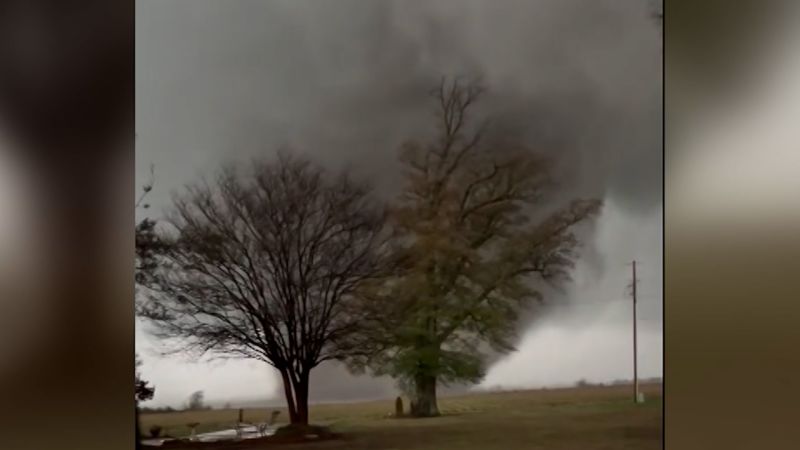
com points out that the storm that hit the West Coast early in the week and then spawned tornadoes in the South could still trigger severe thunderstorms from New York City to the Carolinas, Georgia and northern Florida on Saturday. As a result, there may be delays and cancellations at major airport hubs from metro New York south to Philadelphia, Washington, D.C.
, and Charlotte, N.C. Looking ahead, the Climate Prediction Center’s outlook for March 22-28 has a strong signal for a continuation of above-normal temperatures for late March, as well as above average rainfall.
The U.S. Drought Monitor’s latest update maintains Berkshire County in the abnormally dry, pre-drought category.
The significant drought announced last week by state environmental officials for western New England should be eased by Sunday’s predicted rainfall. Day by day ..
. Saturday: Partly sunny, upper 50s. Mostly cloudy at night, chance of showers, low in the upper 40s.
Sunday: Showers, mainly in the afternoon and at night, windy, high near 65, overnight low around 40. Monday: Morning showers, then clearing in the afternoon, high near 50. Clear overnight, upper 20s.
Tuesday: Sunny, mid-50s. Mostly clear at night, low 35-40. Wednesday: Mostly sunny, low 60s, mostly cloudy after dark, low 40.
Thursday: Mostly cloudy, chance of showers, mid-60s, dropping to the upper 30s by late night. Friday: Cloudy, snow or rain showers, mid-40s, upper 20s overnight. Saturday (March 22): Partly cloudy, mid-40s, nighttime low near 30.
Sources: National Weather Service and AccuWeather.com.


