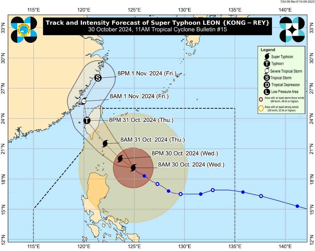
Tropical Cyclone Wind Signal (TCWS) No. 3 has been raised over three areas in Luzon as Tropical Cyclone Leon (international name: Kong-rey) reached super typhoon strength on Wednesday morning, state weather bureau PAGASA said. In its 11 a.
m. bulletin, PAGASA said the following areas are under TCWS No. 3: TCWS No.
2 is hoisted over the following areas: Meanwhile, TCWS No. 1 is also up over the following areas: Leon was located 350 kms east of Calayan, Cagayan with maximum sustained winds of 185 kph near the center and gustiness of up to 230 kph. The super typhoon was moving west northwestward 10 kph.
Leon was expected to move northwestward over the Philippine Sea until it makes landfall along the eastern coast of Taiwan on Thursday afternoon. A second landfall over mainland China has not been ruled out, PAGASA said. According to PAGASA, Leon's landfall over Batanes was also possible.
"LEON will be closest to Batanes from late evening today to tomorrow morning. A landfall in Batanes is also not ruled out," PAGASA said. "This super typhoon will be near or at peak intensity during its closest point of approach to Batanes.
The landfall of LEON over Taiwan will result in a continuous weakening trend for the rest of the forecast period," it added. — VDV, GMA Integrated News.


