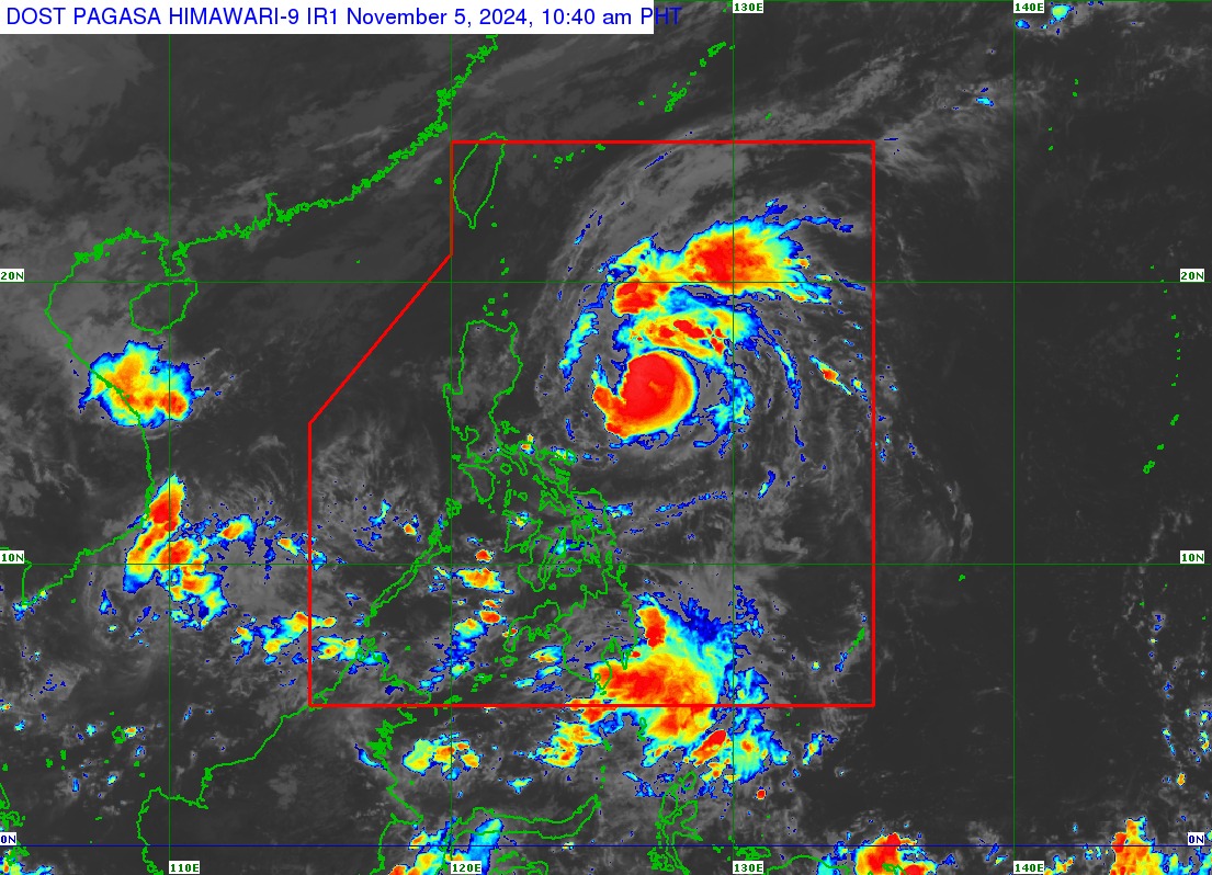
Tropical Cyclone Wind Signal No. 1 is raised over 12 areas in Luzon as Marce intensified into a typhoon on Tuesday morning, according to state weather bureau PAGASA. In its 11 a.
m. bulletin, PAGASA said the following areas are under TCWS No.1 : Marce was last spotted 590 kilometers east of Baler, Aurora moving west northwestward at 30 kilometers per hour (kph), PAGASA said.
The typhoon was packing maximum sustained winds of 120 kph near the center and gustiness of up to 150 kph, it added. PAGASA said Marce may make landfall in the vicinity of Babuyan Islands or over the northern portion of mainland Cagayan on Thursday evening or Friday early morning. Due to uncertainty in the strength of the high pressure area north of Marce, PAGASA said the forecast track may still change and bring the landfall point to the mainland Cagayan-Isabela area.
“MARCE is expected to continue intensifying and may reach its peak intensity prior to possible landfall over Babuyan Islands or Cagayan,” PAGASA said. The typhoon may exit the Philippine area of responsibility on Friday evening or Saturday early morning, according to PAGASA. The National Disaster Risk Reduction and Management Council (NDRRMC) has remained on heightened alert due to Marce.
NDRRMC chairperson and Defense chief Gilberto Teodoro Jr. said concerned agencies are closely monitoring the situation with Marce. Some areas in Cagayan suspended classes on Tuesday, Nov.
5, due to the possible effects of Marce —VAL, GMA Integrated News.


