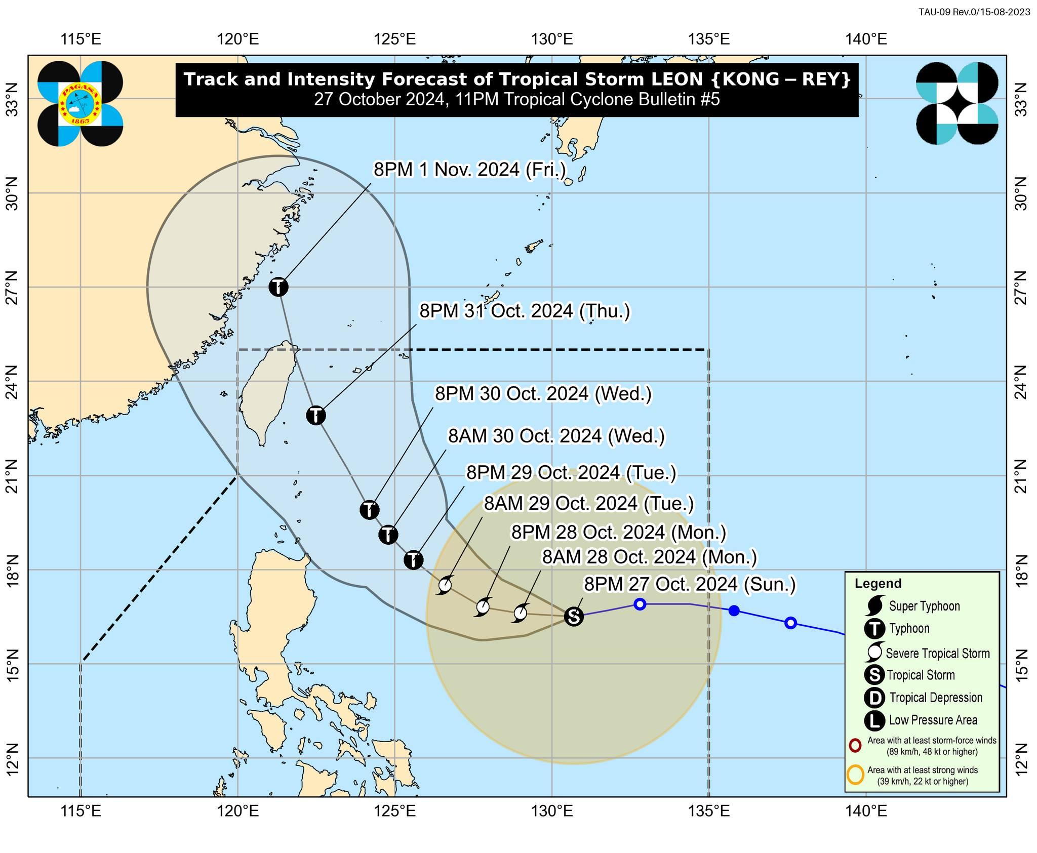
PAGASA has hoisted Signal No.1 over three areas in Luzon as Tropical Storm Leon continues to intensify over the Philippine Sea. According to the state weather bureau in its 11 p.
m. tropical cyclone bulletin on Sunday, these areas are currently under Signal No. 1 as a slightly intensified Leon (international name: Kong-Rey) has continues its westward movement over the Philippine Sea: As of 10 p.
m. Sunday, Leon's center is estimated to be 915 km east of central Luzon, moving west at 20 km/h with maximum sustained winds of 85 km/h near the center and gustiness of up to 105 km/h. Leon is expected to keep intensifying over the next 24 hours and may reach severe tropical storm category on Monday and typhoon category on Tuesday, PAGASA added.
The storm remains far from the Philippine landmass and may eventually come near to, or make landfall in Taiwan. In the meantime, Leon will also bring "strong to gale-force" over Palawan, Romblon, Catanduanes, Sorsogon, Masbate, most of Visayas, Dinagat Islands, Surigao del Norte, and Camiguin tonight, particularly the coastal and upland areas; and to Batanes, Babuyan Islands, Batangas, Most of MIMAROPA, most of Bicol Region, Visayas, most of Northern Mindanao, and most of Caraga Region on Monday. Rough seas are expected in the the seaboards of Batanes; the seaboards of Kalayaan Islands and Babuyan Islands; the northern and eastern seaboards of mainland Cagayan Valley and Catanduanes.
"Mariners of small seacraft, including all types of motorbancas, are advised not to venture out to sea under these conditions, especially if inexperienced or operating ill-equipped vessels," PAGASA said. — BM, GMA Integrated News.


