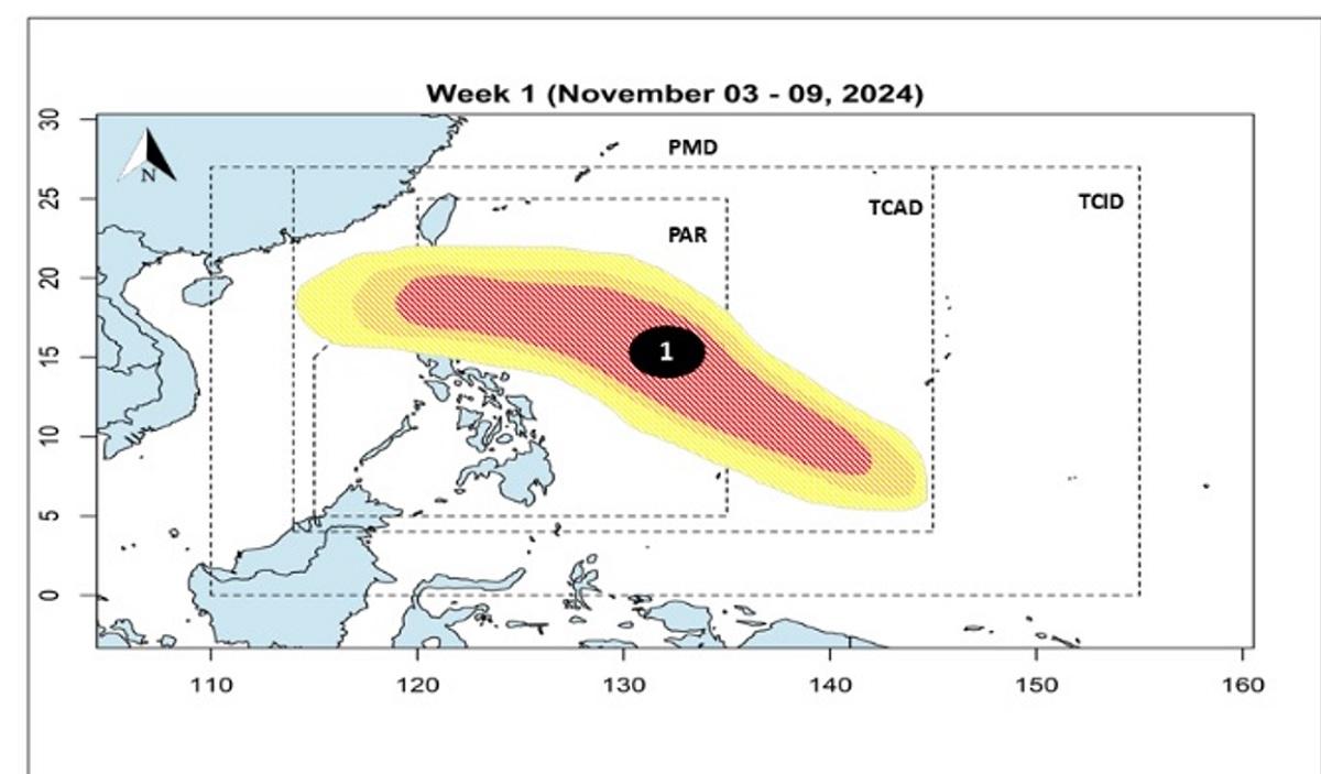
There is a “high chance” that a tropical cyclone (TC) would form in the Tropical Cyclone Information Domain (TCAD) in the first week of November, according to state weather bureau PAGASA. In its forecast on Sunday, PAGASA said a TC-like vortex (LV) is present over the southern boundary of its TCAD from Nov. 3 to 9.
According to PAGASA, tropical cyclones in the TCAD are too far away to have any direct effect on the country but are close enough for closer monitoring. “Model forecasts suggest that TCLV 1 will enter the southeastern boundary of the PAR with up to a high chance of TC development and will likely move closer to northern Luzon,” PAGASA said. Should the forecast persist, the 13th tropical cyclone will enter the Philippine Area of Responsibility and be called “Marce.
” Meanwhile, PAGASA spotted two other TCLVs emerging over the eastern boundary of the PAGASA monitoring domain with a “low to moderate” chance of becoming a storm from Nov. 10 to 16. PAGASA earlier said the country may see one to two tropical cyclones in November.
—Mariel Celine Serquiña/KG, GMA Integrated News.


