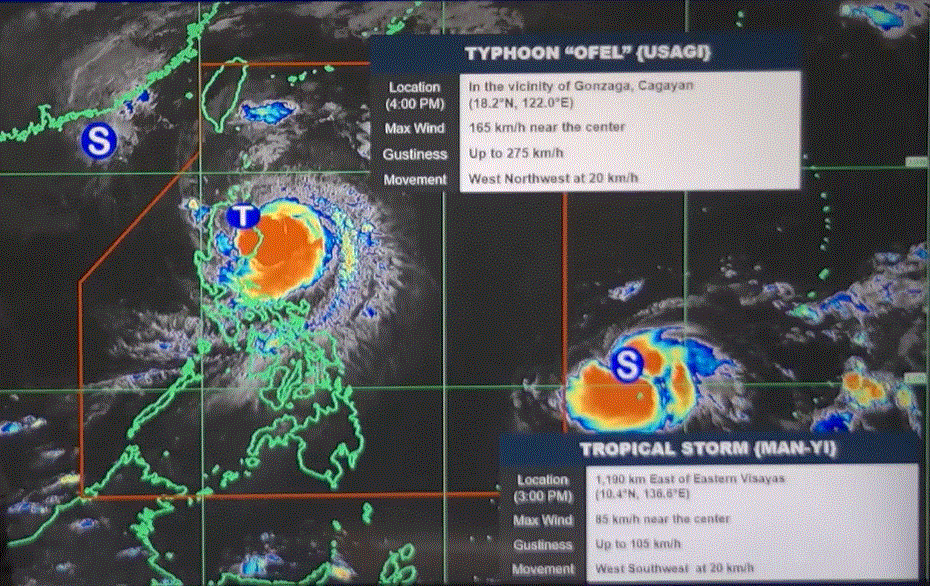
Even as it has weakened, Typhoon Ofel "continues to threaten" parts of northern Luzon and will continue to bring rains and severe winds, PAGASA said. In its 5 p.m.
weather bulletin, the state weather bureau said Signal No. 4 remains hoisted over the following areas: Signal No. 3 is up over the following areas: Signal No.
2 is up over the following areas: Signal No. 1 is up over the following areas: The center of Ofel was estimated in the vicinity of Gonzaga, Cagayan or in Isca, Cagayan. It is moving west northwestward at 20 kilometers per hour and has a maximum sustained winds of 165 km/h near the center and gustiness of up to 275 km/h.
After crossing the northeastern portion of mainland Luzon Thursday afternoon, Ofel will continue moving northwestward and pass close or make landfall in the vicinity of Babuyan Islands in the evening before turning northward on Friday over the sea west of Batanes. It will then move northeastward over the sea east of Taiwan during the weekend. "Ofel has started to weaken due to increasing interaction with the landmass of Luzon.
It will continue to weaken throughout the forecast period due to frictional effects of land, as well as the increasingly unfavorable environment over the Luzon Strait and the sea east of Taiwan," PAGASA said. —LDF, GMA Integrated News.


