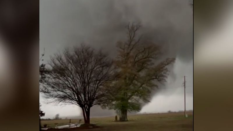
INDIANA, USA — The severe weather season is off to a quick start for Indiana as the early morning hours of Saturday March 15, 2025 brought 8 confirmed tornadoes so far to Indiana. For perspective, the entire state of Indiana usually only gets 2-3 tornadoes on average during the month of March. A nasty line of intense wind storms pushed across the entire state early Saturday morning.
In some areas, the wind surged so much that it helped mechanically spin the air and create tornadoes. Tap HERE for our latest severe weather outlook for Indiana with an ending La Nina pattern for spring 2025. Everyone in Indiana got some rain and thunder and at least a little wind.

So far the National Weather Service offices in Indianapolis , Chicago, Louisville, and Paducah have together confirmed 8 separate tornadoes for Indiana. EF-0 (light blue): 1 tornado EF-1 (green): 4 tornadoes EF-2 (yellow): 3 tornadoes The tornadoes were mainly concentrated in southern and southwestern Indiana. However windy thunderstorms in western Indiana were able to spin-up their own brief tornadoes as well.
Not all the tornadoes have official paths yet. When those are released, we will update our maps. This update is as of 6 p.
m. Sunday (March 16). Expect more confirmations for exact path information the next couple of days as NWS survey crews finalize and publish their reports.
Let's go through all the tornadoes and see what we know so far. The NWS in Chicago has confirmed two brief tornadoes in Lake County just after midnight Friday night into Saturday morning. There is no official path just yet, but there was some minor tornado damage (separate from the wind damage across Lake County) between Schererville and Merrillville.
Some tornado damage was found around Cedar Lake in Lake County, just a bit southwest of Crown Point. EF-1 damage was found. An official path has not been released just yet from NWS Chicago.
NWS Indianapolis found just over 2 miles of damage in southwestern Parke County. Along the leading edge of a line of wind storms, a tornado touched down in Parke County, a few miles west of Rockville. It touched down just west of Mecca and pushed northeast.
It collapsed just before U.S. 36.
Start time: 2:14 AM EDT Rating : EF-1 Est. peak winds: 110 MPH Path Length: 2.66 miles Max Width: 75 yards No injuries / fatalities Southern and southwestern Indiana got the brunt of the tornadoes from the weekend's storms.
That part of the line of wind storms had significant rotation, which eventually weakened by the time it reached eastern Indiana. This tornado started in Pike County, crossed the East Fork White River and trekked all the way across Daviess County into Loogootee where some damage was reported in town. It also skimmed the west side of Dogwood Lake, nearby the Glendale Fish and Wildlife Area.
At first, this was thought to be two separate tornadoes but NWS survey teams think it was one tornado. The survey is not complete for Pike County, but it is for Daviess County. All path information is from Daviess County for now.
Start time: N/A Rating : EF-2 Est. peak winds: 110+ MPH Path Length: 13.66+ miles Max Width: 400+ yards No injuries / fatalities This tornado formed near I-69 just south of the S.
R. 64 exit and pushed northeast into Oakland City. Damage was reported around town.
An official survey has not been released yet, but NWS has confirmed damage points and the EF-2 status. Start time: N/A Rating : EF-2 Est. peak winds: 117 MPH Path Length: N/A Max Width: N/A No injuries / fatalities This tornado formed in rural Gibson County.
This same storm also created the EF-2 tornado Oakland City. An official survey has not been released yet, but NWS has confirmed damage points and the EF-2 status. Start time: N/A Rating : EF-2 Est.
peak winds: 115 MPH Path Length: N/A Max Width: N/A No injuries / fatalities Now let's head to south-central Indiana. This tornado formed just south of the Jackson-Washington State Forecast near Wegan. It tracked northeast before picking up near S.
R. 39. Start time: 5:14 AM EDT Rating : EF-1 Est.
peak winds: 105 MPH Path Length: 2.2 miles Max Width: 50 yards No injuries / fatalities This tornado formed in northern Orange County, Indiana near Orleans. The NWS has not released their official tornado report as of yet.
However, they have provided their damage rating. Start time: N/A Rating: EF-1 Est. peak winds: 95 MPH Path Length: N/A Max Width: N/A No injuries / fatalities Not everyone got tornadoes.
In fact most Hoosiers did not. We all did get some wind, but then some of us picked up hail. The biggest, most frequent hail was in southern Indiana.
The white dots below show wind damage reports. The very pale purple dots show hail reports. Everyone in Indiana picked up some rain.
Most of us at least picked up a half inch of rainfall. Heavier amounts were reported in central and southern Indiana. Much of this was from the secondary round of rain and storms that redeveloped later in the afternoon on Saturday.
These are just a few rainfall reports from across central Indiana as of 6PM Sunday. It was an active weekend, and a very active start to March. Stay with the 13News weather team as more storm systems track toward Indiana.
— 13News Meteorologist Matt Standridge.


