 5 days Ago By Zach White
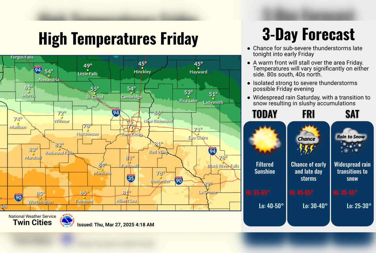
Minneapolis residents can expect a dynamic weather pattern over the next few days, according to the National Weather Service. Today, the city will see partly sunny skies with a high near 60 degrees; however, the calm will shift as a 30 percent chance of showers and thunderstorms emerges after 4 a.m.
tonight. Temperatures are expected to dip to a low of around 47 degrees with an east-southeast wind at about 10 mph. This information was detailed by the National Weather Service.

Heading into the weekend, Friday maintains a minimal chance of early morning thunderstorms before the atmosphere clears to partly sunny with a high nearing 76 degrees. But the weather takes a turn Friday night, where the chance of precipitation is at 40%, and by Saturday, rain becomes likely mostly after 1 p.m.
, along with a notable temperature drop to a high around 41. The forecast also predicts possible new precipitation amounts between a quarter and half an inch.As Saturday night rolls in, residents should brace themselves for a mix of rain and snow before 4 a.
m. and potential snow accumulation of less than an inch. The likelihood of precipitation skyrockets to 90%, and the temperature is expected to hover around 31 degrees, according to forecast details.
Sunday follows with a chance of snow before 3 p.m., showing a mostly cloudy day with a high near 42 degrees.
The weather outlook for early next week promises a respite from the wintry mix. Monday is forecasted to be mostly sunny, with highs creeping up near 44 degrees, yet nighttime will be partly cloudy, and temperatures will drop to around 27. However, a chance of rain and snow might return Tuesday and presumably intensify into Tuesday night with an 80% chance of rain and snow.
The National Weather Service's Hazardous Weather Outlook further emphasizes that severe weather is not anticipated tonight, though the area should be vigilant Friday evening as there is a Marginal Risk of severe weather, including large hail and gusty winds. The advisory extends a call for SKYWARN spotter activation, which may be needed to monitor these conditions..