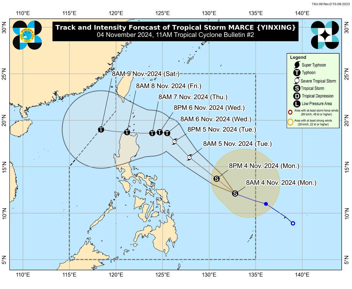
Tropical Storm Marce slightly intensified and its trough is expected to bring rains over the Extreme Northern Luzon and the eastern section of Luzon starting Monday or Tuesday, PAGASA said. In its 11 a.m.
bulletin on Monday, PAGASA also said Marce may enhance the northeasterly wind flow which may occur within the week. “Tropical Cyclone Wind Signal No. 1 may be hoisted over portions of Cagayan by tomorrow.
The highest Wind Signal which may be hoisted during the occurrence of MARCE is Wind Signal No. 4,” PAGASA said. Due to the northeasterly wind flow, strong to gale-force gusts are expected on Monday in Batanes, Cagayan including Babuyan Islands, Isabela, Ilocos Norte, Aurora, and the northern portion of Quezon.
Rough seas of up to 3.5 meters may be experienced in the seaboards of Batanes, Babuyan Islands, Ilocos Norte, and Ilocos Sur. “Mariners of small seacrafts, including all types of motorbancas, are advised not to venture out to sea under these conditions, especially if inexperienced or operating ill-equipped vessels,” PAGASA said.
Waves of up to 2.5 meters are expected over the seaboards of mainland Cagayan, Isabela, Aurora, and the northern and eastern seaboards of Polillo Islands, the remaining seaboards of Ilocos Region, the seaboards of Northern Quezon, Camarines Norte, the northern and eastern seaboards of Catanduanes, the eastern seaboard of Albay, the eastern seaboard of Sorsogon, Northern Samar, and the eastern seaboard of Eastern Samar. “Mariners of motorbancas and similarly-sized vessels are advised to take precautionary measures while venturing out to sea and, if possible, avoid navigation under these conditions,” PAGASA said.
A Gale Warning will likely be hoisted over the seaboard of Northern Luzon Tuesday evening or on Wednesday, PAGASA said. Marce location Marce was located 775 kilometers east of Borongan City, Eastern Samar moving west northwestward at 35 km per hour (kph), packing maximum sustained winds of 75 kph near the center and gustiness of up to 90 kph. PAGASA said Marce may make landfall over the vicinity of Babuyan Islands or mainland northern Cagayan on Thursday evening or Friday early morning.
“Due to uncertainty in the strength of the high pressure area north of MARCE, the forecast track may still change and bring the landfall point to mainland Cagayan-Isabela area,” PAGASA added. Marce is expected to gradually intensify and may reach severe tropical storm category by Tuesday and even typhoon level by Tuesday evening or early Wednesday morning. “Rapid intensification is likely,” PAGASA said.
— RSJ, GMA Integrated News.


