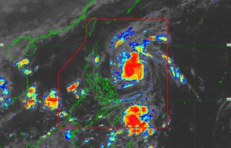
Severe Tropical Storm Marce slightly intensifies and is nearing Typhoon category while five areas remain under Signal No. 1, according to the latest Tropical Cyclone Bulletin posted by PAGASA. The center of Severe Tropical Storm Marce was estimated at 735 kilometers east of Baler, Aurora packing maximum sustained winds of 110 kilometers per hour near the center, gustiness of up to 135 km/h, and central pressure of 975 hPa.
Marce is moving northwestward at the speed of 25 kph with strong to storm-force winds extend outwards up to 580 km from the center. Tropical Cyclone and Wind Signal No. 1 is hoisted over the following areas: There will be moderate to heavy rainfall over Cagayan province, according to Weather Advisory No.
2 posted by PAGASA. Cagayan Valley, Apayao, Kalinga, Quezon, and Bicol Region will have cloudy skies with scattered rain showers and thunderstorms due to Severe Tropical Storm Marce with the possibility that flash floods or landslides will occur due to moderate to at times heavy rains. Eastern Visayas and Aurora will have partly cloudy to cloudy skies with isolated rain showers or thunderstorms due to Marce with the possibility that flash floods or landslides will occur during severe thunderstorms.
Metro Manila and the rest of the country will have partly cloudy to cloudy skies with isolated rain showers or thunderstorms due to localized thunderstorms with the possibility that flash floods or landslides will occur during severe thunderstorms. Severe Winds PAGASA reported that the northeasterly wind flow will also bring strong to gale-force gusts over the following areas (especially in coastal and upland areas exposed to winds): Ilocos Sur, Aurora, Quezon, and Camarines Norte. Hazards affecting coastal waters A Gale Warning is hoisted over the northern and eastern seaboards of Northern Luzon.
The wind speed forecast for Northern Luzon and the eastern section of Southern Luzon is moderate to strong and moving northeastward while coastal waters will be moderate to rough. The rest of Luzon will experience moderate to strong wind speed moving in the northeast to east direction with moderate to rough coastal waters. The rest of the country will have light to moderate wind speed moving in the northeast to northwest direction while coastal waters will be slight to moderate.
Track and Intensity outlook Marce is forecast to move generally west northwestward today until Wednesday morning before decelerating and turning westward over the Philippine Sea east of Extreme Northern Luzon. The weather bureau added that Marce may make landfall in the vicinity of Babuyan Islands or over the northern portion of mainland Cagayan on Thursday evening (7 November) or Friday (8 November) early morning. "Due to uncertainty in the strength of the high pressure area north of Marce, the forecast track may still change and bring the landfall point to mainland Cagayan-Isabela area.
Marce may exit the Philippine Area of Responsibility (PAR) region on Friday evening or Saturday (9 November) early morning," said PAGASA. — BAP, GMA Integrated News.


