 1 week Ago By Dan Robinson
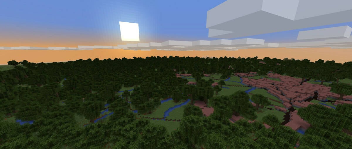
Have you ever wanted to explore a blocky low-resolution version of the UK? Well, you're in luck, because the Ordnance Survey has created a Minecraft representation of it, claimed to be as realistic as anything ever can be in the game. The pasture land and heathland of the New Forest, in southern England, in block form (c) Ordnance Survey – click to enlarge The beautiful Welsh mountain of Snowdon in Eryri, Snowdonia National Park, (c) Ordnance Survey – click to enlarge Inspired by the new A Minecraft Movie , Britain's national mapping agency has created a complete representation of the country, with all the surrounding islands, using its own detailed map data. This cubist version of the British Isles is estimated to be made up of more than 100 billion blocks, and contains all the features you would expect to see, such as motorways and roads, vegetation, meadows, woodland, lakes, rivers, sand beaches, railways and islands.
By bringing its map data into gaming, the Ordnance Survey says it has created an interactive, realistic representation of Britain that brings geography and mapping to both younger generations and seasoned gamers, or anyone keen to explore and learn about these islands. The streets of the famous port city of Southampton, an important port since the Romans were in Britain and the Titanic's first port of departure on its final journey (c) Ordnance Survey – click to enlarge However, due to the sheer size of this binary Blighty, the agency says it decided to release 16 areas of Britain first to improve the gaming experience for players. These include London, Manchester, Cardiff, Ben Nevis, Cornwall, Isle of Wight, Bristol, Edinburgh, Birmingham, Western Islands, Shetland Islands, Hampshire, Cumbria, Glasgow, Newcastle and Snowdonia, all individually downloadable.

This isn't the first time the Ordnance Survey team has done this. Back in 2014, they scored a place in the Guinness Book of Records for the largest real-world place in Minecraft, for..
. a representation of Great Britain containing 83 billion blocks. And you think you're slacking off for sneakily checking your social media at work.
This build was developed by Ordnance Survey graduate and Minecraft enthusiast Jonathan Allsup, who created and processed the map at the agency's headquarters in Southampton. "The latest version is a natural advancement in quality and size as more resources became available for this work, which means everything looks so much better and more detailed than 10 years ago," Allsup said. "We want this to be a resource for anyone to try.
Ordnance Survey is an organisation founded on exploration and we encourage anyone to do to the same with these maps!" St Michael's Mount, Cornwall, on the southwest coast of England (c) Ordnance Survey – click to enlarge According to the agency, this virtual Albion looks much more realistic, with more detailed vegetation, buildings in 3D, and sandy beaches among the improvements to the world's visual quality. So it claims, but as is usual with Minecraft, the blockiness sometimes means you wouldn't guess from looking at most of the images where they are supposed to be a representation of. Don't simply take our word for it, if you are a Minecraft fan, why not check it out at the Ordnance Survey website .
®.