 2 days Ago
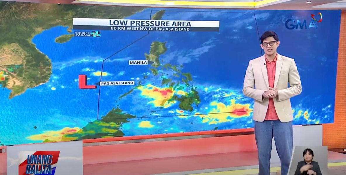
A low pressure area (LPA) will affect Palawan on Monday, while the easterlies and northeasterly windflow will affect the other parts of the country, PAGASA said in its weather forecast. The LPA was estimated by PAGASA to be located at 80 km west northwest of Pag-asa Island which is outside the Philippine Area of Responsibility (PAR). "Mababa po ang tsansa nitong maging bagyo," Anjo Pertierra reported on Unang Balita.
(It has a low chance of becoming a tropical depression.) Despite this, the LPA will cause cloudy skies with scattered rains and thunderstorms over Palawan. Moderate to at times heavy rains may possibly lead to flash floods or landslides.

Meanwhile, Batanes will have cloudy skies with light rains due to the northeasterly windflow, but no significant impact is expected. Eastern Visayas, Bicol Region, Zamboanga Peninsula, Quezon, Dinagat Islands, and Surigao del Norte may have cloudy skies with scattered rains and thunderstorms due to the easterlies. Flash floods or landslides may possibly result due to moderate to at times heavy rains.
Metro Manila and the rest of the country on the other hand will experience partly cloudy to cloudy skies with isolated rain showers or thunderstorms due to the easterlies. Some areas may have flash floods or landslides as a result of severe thunderstorms. Coastal waters will be moderate to rough in Northern Luzon, and slight to moderate in the rest of the country.
Sunrise was at 5:53 a.m. while sunset will be at 6:08 p.
m. —KG, GMA Integrated News.