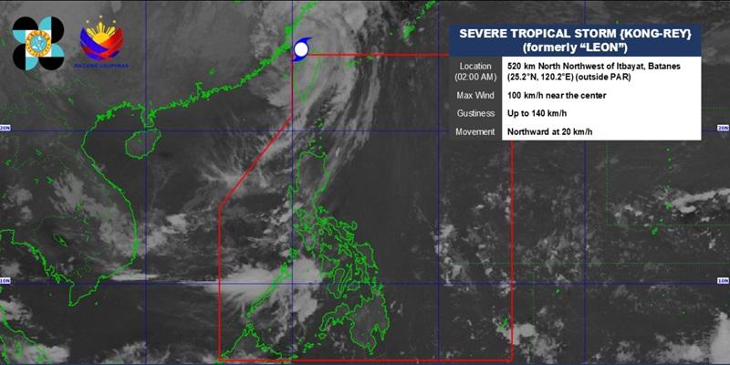
Leon has been degraded into Severe Tropical Storm and exited the Philippine Area of Responsibility early Friday morning, according to the 5 a.m. Tropical Cyclone Bulletin posted by PAGASA.
The center of the eye of Leon was estimated at 550 kilometers north northwest of Itbayat, Batanes, outside PAR, packing maximum sustained winds of 100 kilometers per hour near the center and gustiness of up to 140 kph. Leon is moving northward at the speed of 20 kph. Hazards affecting land areas Zambales, Bataan, Occidental Mindoro, and Palawan will have cloudy skies with scattered rains and thunderstorms due to the trough of STS Kong-Rey (formerly Leon) with the possibility that flash floods or landslides will occur due to moderate to at times heavy rains.
Metro Manila and the rest of the country will have partly cloudy to cloudy skies with isolated rain showers or thunderstorms due to localized thunderstorms with the possibility that flash floods or landslides will occur due to severe thunderstorms. The wind speed forecast for Northern Luzon is strong and moving in the southwest to south direction and rough coastal waters. The rest of Luzon will have moderate to strong wind speed moving in the southwest to south direction while coastal waters will be moderate to rough.
Visayas will experience light to moderate wind speed moving in the southwest to south direction while coastal waters will be slight to moderate. The wind speed forecast in Mindanao is light to moderate moving in the northeast to east direction while coastal waters will be slight to moderate. Severe Winds The wind flow coming towards the circulation of Leon will also bring gusty conditions (strong to gale-force) over the following localities (especially in coastal and upland areas exposed to winds) outside Wind Signal areas: Batanes, Babuyan Islands, northeastern mainland Cagayan, and eastern Isabela.
Track and Intensity Outlook Leon is now outside the Philippine Area of Responsibility and is heading towards the East China Sea and is forecast to further weaken throughout the forecast period due to unfavorable environmental conditions. No Tropical Cyclone Wind Signal was raised. Sunrise will be at 5:52 a.
m., sunset at 5:28 p.m.
— BAP, GMA Integrated News.


