 3 days Ago
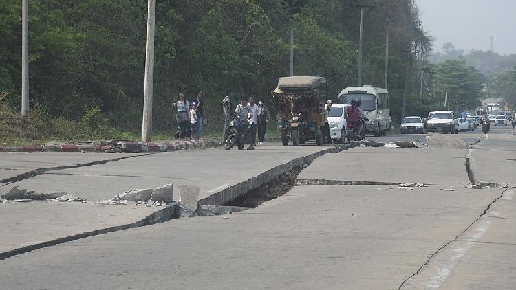
A powerful magnitude-7.7 earthquake struck central Myanmar on Friday, causing widespread devastation. The confirmed death toll from the earthquake has risen to 1,644.
Experts from the China Earthquake Networks Center have analyzed the recent seismic activity near Myanmar, identifying the earthquake's location within the Myanmar Arc region. According to their research, intense collisions between the Indian and Eurasian plates since the Cenozoic era have led to significant lithospheric compression, resulting in the formation of the Himalayan orogenic belt. The Myanmar Arc, situated at the eastern tectonic junction of the Himalayas, is characterized by strong crustal deformation and high seismic activity.

This region has developed a series of north-south-trending structural units and faults, making it one of the most earthquake-prone areas along the Himalayan seismic belt. Historical data indicates that since 1900, ten earthquakes of magnitude 7.0 or higher have occurred within a 300-kilometer radius of the recent epicenter.
The most powerful recorded event was an 8.0-magnitude earthquake on May 23, 1912, within Myanmar's borders..