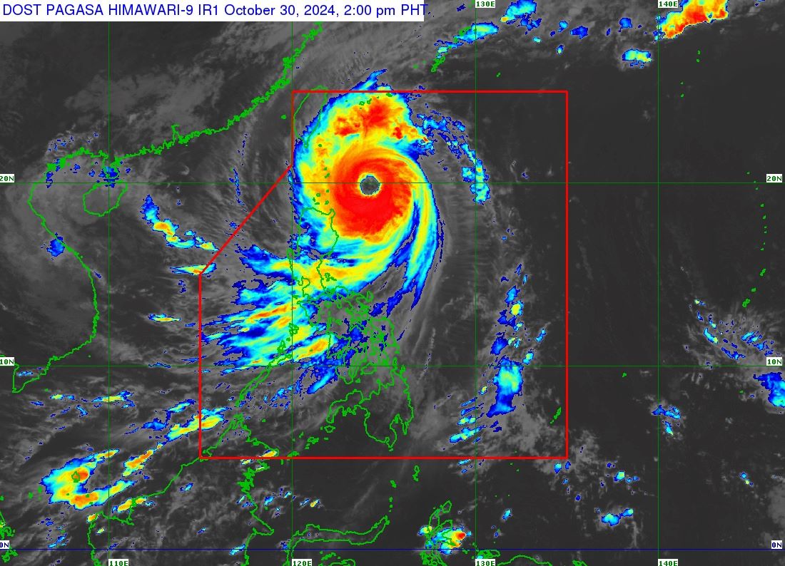
Signal No. 4 was raised over Batanes as Super Typhoon Leon (international name: Kong-Rey) moved closer to the province, the state weather bureau PAGASA said Wednesday afternoon. Winds of 118 to 184 km/h are expected in Batanes in the next 12 hours that could pose ''significant to severe threat to life and property,'' according to PAGASA's 2 p.
m. bulletin. ''The hoisting of Wind Signal No.
5 is also not ruled out should Leon move to the left of its forecast track,'' PAGASA said. Signal No. 3 was hoisted over the eastern portion of Babuyan Islands (Babuyan Islands, Camiguin Islands, Calayan Islands).
Under Signal No. 2 are the following areas: Signal No. 1 was raised over the following areas: PAGASA said strong to gale-force gusts would occur over most of the Cordillera Administrative Region, Quirino, Nueva Vizcaya, Aurora, Bataan, Metro Manila, Calabrzon, MIMAROPA, Bicol Region, Northern Samar, and most of Western Visayas on Thursday.
State meteorologists warned of moderate to high risk of life-threatening coastal flooding due to storm surge with peak heights exceeding 3.0 m above normal tide levels over the low-lying or exposed coastal localities of Batanes and Babuyan Islands. A gale warning was also hoisted over the seaboard of Northern Luzon and the eastern seaboards of Central and Southern Luzon.
At 1 p.m., Leon was located 310 kilometers east of Calayan, Cagayan, with maximum sustained winds of 185 km/h and gustiness of up to 230 km/h.
It was moving northwestward at 15 km/h. According to the state weather bureau, Leon making landfall over Batanes is possible. "Leon will be closest to Batanes from late evening today to tomorrow morning.
A landfall in Batanes is also not ruled out," PAGASA said. "This super typhoon will be near or at peak intensity during its closest point of approach to Batanes. The landfall of Leon over Taiwan will result in a continuous weakening trend for the rest of the forecast period," it added.
The typhoon is forecast to move northwestward over the Philippine Sea until it makes landfall along the eastern coast of Taiwan on Thursday afternoon. Leon is expected to exit the Philippine Area of Responsibility on Thursday evening or early Friday morning. Evacuation Thousands of residents in several Luzon provinces have fled their homes as Leon continued to bring rains and strong winds, GMA Integrated News' Unang Balita reported Wednesday.
In Tuguegarao City in Cagayan, some residents who were about to return to their homes after Severe Tropical Storm Kristine left the country decided to stay in evacuation centers due to Leon’s threat, Jonathan Andal reported. Meanwhile, those who already went back to their homes were advised to evacuate again by the city government. From 70 families, only nine families were still staying in an evacuation center in Barangay Balzain East.
In Sta. Ana town, 25 more families also evacuated. Around 4,000 residents already left their homes in the province and most of them were from Baggao with 2,000 evacuees.
It was also in Baggao where the body of an elderly man who was missing for three days amid the onslaught of Kristine was retrieved from the Pared River. In Occidental Mindoro, travelers were already rushing to seaports as trips amid the possible threat from Leon in the coming days, according to a report of Mav Gonzales. The Provincial Disaster Risk Reduction and Management Office is monitoring the situation and tents are already set up for possible evacuees.
— Mariel Celine Serquiña/VBL, GMA Integrated News.


