 6 hours Ago By Samuel Tan
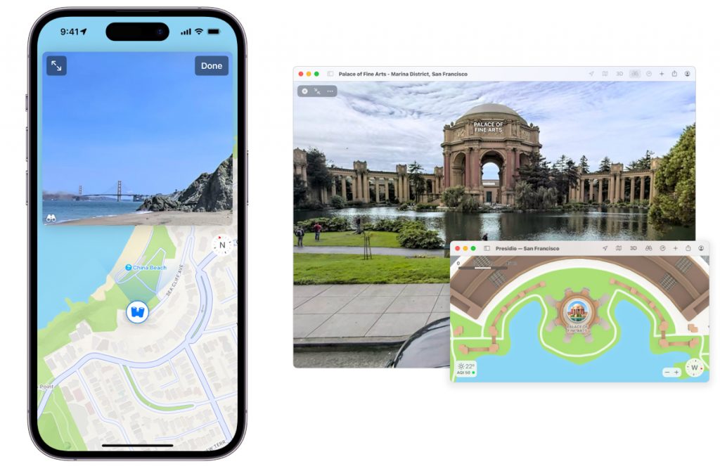
Apple will be sending people to walk around the streets of Kuala Lumpur, Pulau Pinang, Johor, and Melaka, carrying portable backpacks beginning today ( 18th of October 2024 ). This is part of the company’s initiative to rebuild its Apple Maps service, which will include the introduction of new features such as the Google Maps Street View-like Look Around feature. If you recall, Apple announced the deployment of its imaging vehicles across all states and Federal Territories in Malaysia between November 2023 and July 2024 .
We even spotted one of the Subaru XVs used for the Apple Maps image collection in Subang Jaya earlier this year . However, there are certainly areas where cars can’t drive into, which is where the portable backpack system comes in, allowing Apple to collect imagery and LiDAR data in those areas. The backpack data-gathering system is essentially a more compact version of the vehicle collection system, but it still allows Apple to collect LiDAR points and cloud imagery.
Aside from backpacks, Apple will also use other devices such as iPads or iPhones to collect data. These backpacks will be collecting data from locations such as pedestrian-only streets, parks, plazas, and so on. It can also include transit stations, where data can be used to create 2-D maps.
Apple has also published a schedule for its portable backpack ground survey exercise, across all four regions mentioned above, which will be taking place simultaneously between the 18th of October 2024 and the 31st of December 2024 . And of course, privacy is one of Apple’s main priorities in rebuilding its map. The company says that it’s committed to protecting user privacy while collecting this data, by censoring faces and licensing plates on images that are published in Look Around.
The Apple Maps rebuild was announced by the Cupertino-based company back in 2018, to better compete with Google Maps, considering how disastrous its 2012 launch was . So far, Apple’s new map has already been rolled out across Hong Kong, Taiwan, the United States, the United Kingdom, and so on, with more and more countries to be added each year. However, looking at the scale of the rebuild, do not expect the Malaysian maps to be updated so soon.
Here’s Apple’s full quote: Apple is conducting surveys with portable systems in select pedestrian areas (for example, certain streets in Kuala Lumpur that cannot be driven). Some pedestrian surveys use a backpack system to collect data that may be used directly in Apple Maps, such as in the Look Around feature. Other pedestrian surveys use iPads, iPhones or other devices to collect data for map improvement purposes.
These pedestrian surveys allow us to improve and update Apple Maps in areas where vehicles simply can’t go while using the same privacy protections as the Apple Maps vehicles. We are committed to protecting your privacy while conducting these surveys. For example, we will censor faces and license plates on images that are published in Look Around.
.